The edge · 600 ft · shelf break and canyons
White Marlin
Kajikia albida. Out of season in every region we cover this month.
LaneThe edge · 100 fa (600 ft)
Depth it holds328–6562 ft
Prime water75–82°F (workable 75–88°F)
Holds in the column16–230 ft down below the surface, over 328–6562 ft of water
Judged onsurface temperature (NASA MUR satellite)
Structurenone
In 3D
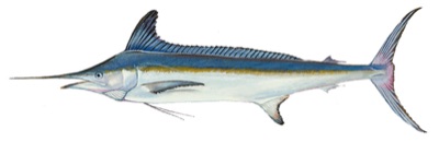
Drag to rotate, pinch or scroll to zoom. 3D model traced from a Raver Duane, U.S. Fish and Wildlife Service, Public domain reference — source.
.png)
How it's fished
Troll naked ballyhoo with dredges over 50-100 fathom lumps and edges.
Region by region — right now
| Region | Season | Prime water | Temp | Fish it at | Months |
|---|---|---|---|---|---|
| Mid-Atlantic | off-season | reaches Montauk | 75°F | — | J F M |
| Southeast Atlantic | off-season | reaches Cape Hatteras | 82°F | 16–230 ft | J F M A M |
| Gulf of Mexico | off-season | reaches Tampa | 86°F | 16–203 ft | J F M A |
"Fish it at" is where this species' temperature band and its holding depth overlap in the water column, from the RTOFS profile (13 levels, 0–300 m) — the depth to actually put a bait, not just the place. "Prime water" is the furthest sampled station on the 100-fathom lane whose surface temperature sits inside this species' band. It is water, not a sighting report.
Charted grounds on the 100-fathom lane