The grounds · 180 ft · banks, ledges and wrecks
Canary Rockfish
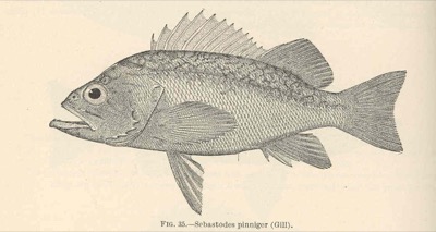
Sebastes pinniger. Prime water reaches Neah Bay in Pacific Northwest right now (48°F on the bottom).
LaneThe grounds · 30 fa (180 ft)
Depth it holds230–656 ft
Prime water45–55°F (workable 45–61°F)
Holds in the column230–656 ft down (on the bottom)
Judged onseabed temperature (RTOFS at depth)
Structurerequires deep pinnacles and rock edges
The water column off Neah Bay
The strip is the water itself, coloured by temperature from the surface down to the 177 ft surveyed bottom at that spot — one band per RTOFS model level. The outlined stretch is where Canary Rockfish's temperature band (45–61°F) and the depth it holds actually overlap. That thickness is the number that matters: it is how much water you can work, not just whether the spot is warm enough somewhere. One model cycle, not a weekly archive — this holds still while the surface map scrubs.
In 3D
Drag to rotate, pinch or scroll to zoom. 3D model traced from a Warren E. Savary / U.S. Food and Drug Administration, United States government work; public domain reference — source.
How it's fished
Deep rock and pinnacle edges — they school off the bottom above the structure.
Region by region — right now
| Region | Season | Prime water | Temp | Fish it at | Months |
|---|---|---|---|---|---|
| Pacific Northwest | in season | reaches Neah Bay | 48°F | — | J F M A M J J A S |
| California | in season | reaches San Francisco | 55°F | — | J F M A M J J A |
"Fish it at" is where this species' temperature band and its holding depth overlap in the water column, from the RTOFS profile (13 levels, 0–300 m) — the depth to actually put a bait, not just the place. "Prime water" is the furthest sampled station on the 30-fathom lane whose seabed temperature sits inside this species' band. It is water, not a sighting report.